Inaccessible Lands
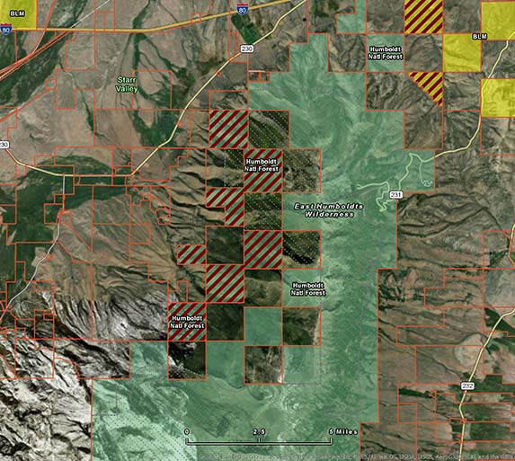
Back when private-land permissions were readily acquired, this was not a serious obstacle to sporting access. But as land ownership patterns have shifted, sportsmen and women more and more frequently encounter no-trespassing signs and gated roads, and inaccessible public lands now present a major barrier to hunting and fishing. Surprisingly though, little has been done to understand the scope of the problem, its effect on our hunting and fishing opportunities, or what it will take to systematically unlock these lands—until now.
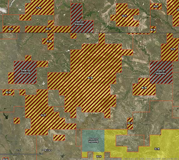
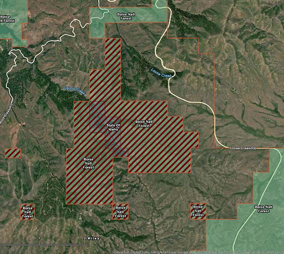
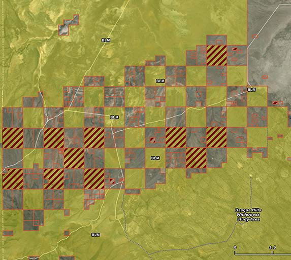
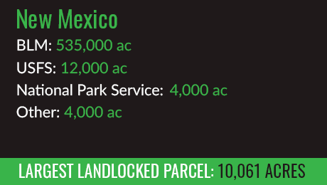
State By State




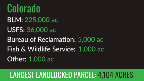


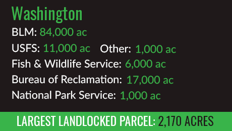

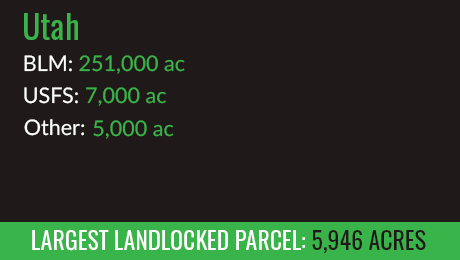
Landlocked Hotspot
Southeast Montana
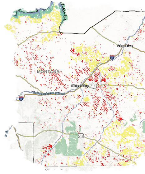
Montana Department of Fish, Wildlife, and Parks Region 7 is a mule deer hunter’s paradise—but it also contains a disproportionately high percentage of landlocked lands. From the shores of Fort Peck Lake to the Tongue and Powder Rivers, more than 898,000 acres of public land within Region 7 are not accessible, unless permission is granted from an adjacent private landowner. Other sub-regions throughout the West, including eastern Wyoming and northern Nevada, contain similarly high concentrations of landlocked lands. Unlocking these areas’ inaccessible public lands would both expand hunting opportunities and benefit small-town economies.
Total Landlocked
Federal Acreage
898K
Overall Total Acres
of Federal Land
3.89M
MONTANA
FWP
REGION 7
 LANDLOCKED IN FWP REG 7
 USFS
USFS BLM
BLM CHARLES M. RUSSEL REFUGE
LWCF: The Key To Unlocking Public Lands
Help Unlock Public Lands:
Send a Message to Your Lawmakers Now
If policymakers are serious about improving public land access for hunting and fishing, they need to pass a permanent reauthorization of the Land and Water Conservation Fund with full, dedicated annual funding.
Since 1964, the LWCF has opened more than 5 million acres of public land, invested more than $16 billion in conservation and outdoor recreation, established new public fishing areas, unlocked previously inaccessible public lands, and enabled the strategic acquisition of additional public lands for the benefit of hunters, anglers, and everyone who enjoys the outdoors.
Although the Land and Water Conservation Fund is the single most powerful tool for opening landlocked public lands and connecting even more Americans to their best days afield, the program is set to expire on September 30, 2018. If this were to occur, conservation groups and public land management agencies would have limited ability to open and expand access to America’s public lands, despite the commitment of many public officials to do just that.
LWCF Success Stories
LWCF Access Success Story:
THIRTYMILE CREEK –
THE JOHN DAY RIVER
The John Day River and its tributaries have long been among the West’s premier destinations for sportsmen and women. Anglers chase world-class steelhead and smallmouth bass in the unique setting of central Oregon’s high desert, and hunters lucky enough to draw a tag for the area’s elk, mule deer, or bighorn sheep will forever remember their time on this steep and rugged landscape.
Near the small town of Condon, the John Day is joined by Thirtymile Creek, a critical spawning area for some of the watershed’s most significant runs of wild steelhead. Up and downstream from Thirtymile Creek, more than seventy miles of the John Day Wild and Scenic River canyon are flanked on both sides by public BLM lands, offering outstanding fishing, hunting, hiking, and boating opportunities. Until recently, however, the only direct access to the river in its lower nine miles was controlled by private ranches and reachable only by boat or with adjacent landowner permission.
In 2014, Western Rivers Conservancy began an ambitious, multi-phase effort to secure permanent public access to the John Day River at Thirtymile Creek and create new recreational access to the wealth of public lands above and below the tributary. Working with willing sellers, WRC purchased two ranches to conserve 11,148 acres of fish and wildlife habitat and enhance public access to the John Day.
In 2018, WRC transferred the first 4,082 acres to the BLM using LWCF funding, forever securing access to the river and previously landlocked BLM parcels. The remaining ranchlands are slated for conveyance to the BLM by early 2019, again using funds from LWCF. In all, WRC’s efforts will add 11,148 acres of public hunting and fishing grounds to the public trust, unlock 2,323 acres of entirely landlocked BLM lands, and improve access to an additional 75,000+ hard-to-reach public acres.
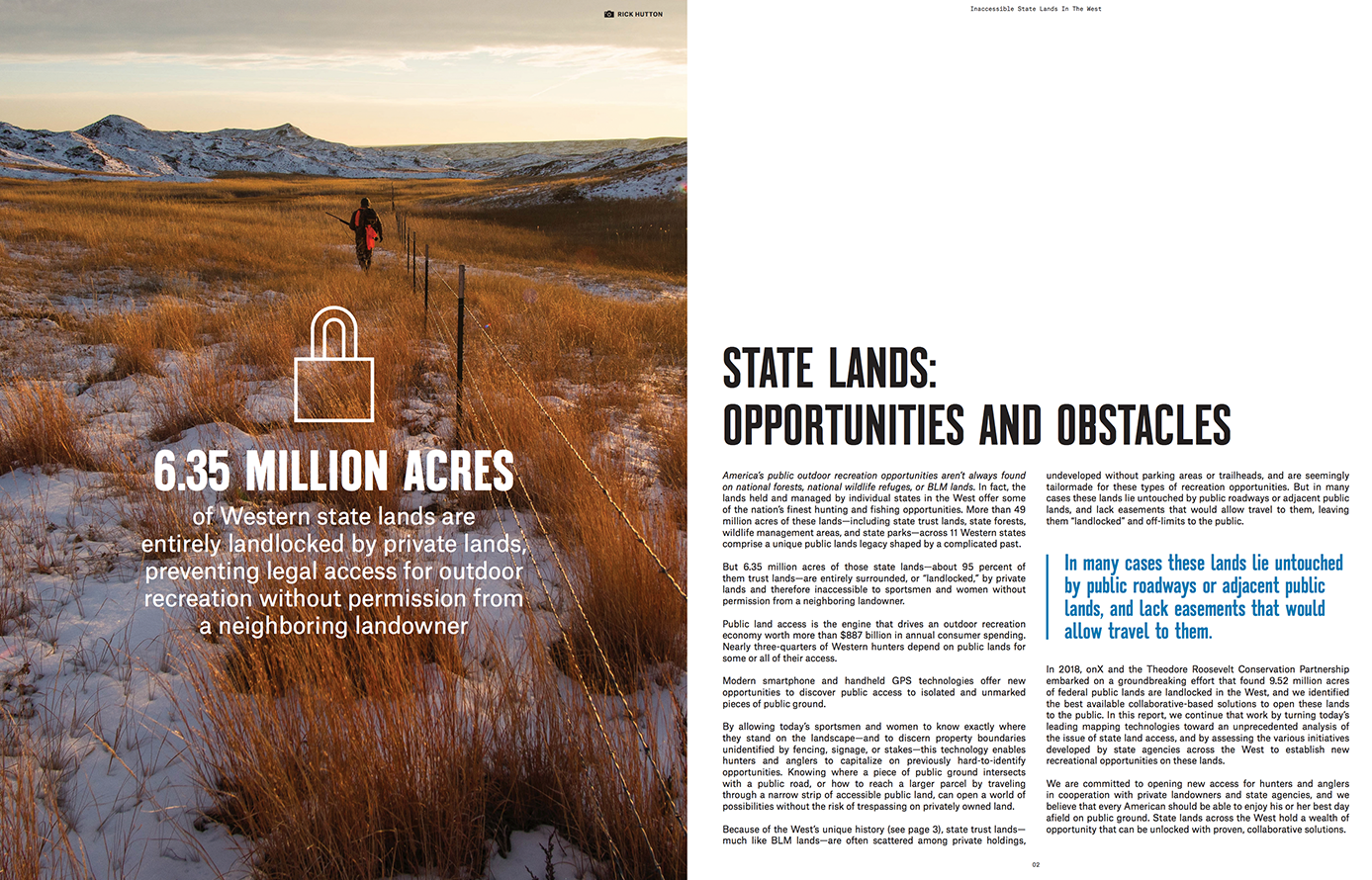
Download The Landlocked Report
DOWNLOAD THE REPORT
Download a .pdf of the full onX-TRCP report for a detailed analysis of the landlocked lands problem, and what it will take to solve it.
